SiteMetrix Construction Site Management Software
SiteMetrix Grade
SiteMetrix Survey
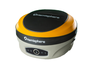
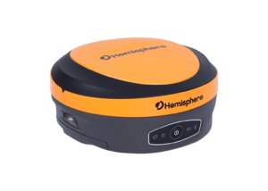
Hemisphere GNSS’ universal construction site supervisor system, including SiteMetrix and the all-new multi-GNSS, multi-frequency C631 RTK Base & Rover, is the ultimate tool to help you manage all of your job site activities. SiteMetrix is designed to be user friendly, easy to understand, portable, and expandable. Use the system to localize sites, check grade, configure base stations, calculate volumes of materials moved, store points, and much more.
Manage Your Construction Jobsite
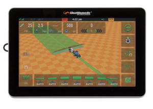
Hemisphere’s SiteMetrix is a complete 3D / GNSS site management and inspection tool, implementing most grading and excavating applications:
- Provides cut and fill information across the job site in real-time moving easily between a vehicle to a man-rover pole
- Supports most GNSS receivers by offering the world’s largest GNSS library
- Easy-to-use stakeout, collection, volume computations and reporting, and as-built points
- Provides an incredible amount of direct import files, including DWG, DXF, TN3, GC3, LN3, TIN, and GRD
- Customizable user interface, SiteMetrix can be as easy or advanced as necessary
SiteMetrix Grade Benefits:
- Reduce costs by setting out and checking grade in-house
- Minimize external survey fees
- Calculate volumes of stockpiles or volumes of material moved
- Obtain real-lime estimates of volumes, material. and job completion
- Create files of completed areas of projects
- Check grade from your truck with supervisor mode
- Finish Jobs faster and more efficiently with less cost and material
SiteMetrix Survey Solution Key Features:
- Easy-to-use
- Collect data and perform stake-out efficiently
- Supports multiple local coordinates systems
- Share coordinate system with QR code
- Graphical stakeout interface
- Import map in SHP/DXF/DWG/XML formats
- Export in DXF/KML/CSV/Customs file formats
- Powerful CAD function
- Online Google street and satellite maps
- Support feature codes
- Android OS


Contact Our Team
Need to chat? Complete the form below and we will respond within 24 to 48 business hours.
Related Products
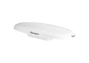
A631 GNSS Smart Antenna
- Scalable Dual-Frequency, Multi-GNSS
- GPS, GLONASS, BeiDou, and Galileo
- Athena™ RTK, Atlas® L-Band, and SBAS-Capable
- 800+ Channels
- 10 Hz Update Rate (20 Hz Optional)
OEM Development Kit ST
OEM Development Kit ST The Universal Development Kit ST allows you to integrate a Hemisphere GNSS OEM board into your design. The Universal Development Kit ST supports the following Hemisphere GNSS OEM boards:
- Vega™-based OEM boards
- Phantom™-based OEM boards
Related Products
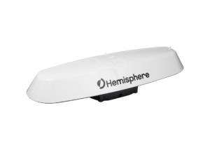
Vector™ V123 & V133 GNSS Smart Antennas
- Single-Frequency, Multi-GNSS
- GPS, GLONASS, BeiDou, Galileo, and QZSS
- Atlas® L-Band, Beacon (V133), and SBAS-Capable
- 511 Channels
- 20 Hz Update Rate (50 Hz Optional)
- 0.3º Heading Accuracy
Vector™ V500 GNSS Smart Antenna
- Designed Specifically for Marine Applications
- Multi-Frequency, Multi-GNSS
- GPS, GLONASS, BeiDou, Galileo, QZSS, and IRNSS
- Athena™ RTK, Atlas® L-Band, and SBAS-Capable
- 1100+ Channels
- 10 Hz Update Rate (20 Hz Optional)
- 0.27º Heading Accuracy
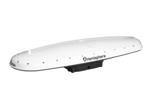
Vector™ VR500 GNSS Smart Antenna
- Designed Specifically for Construction & Mining Applications
- Multi-Frequency, Multi-GNSS
- GPS, GLONASS, BeiDou, Galileo, QZSS, and IRNSS
- Athena™ RTK, Atlas® L-Band, and SBAS-Capable
- 1059 Channels
- 10 Hz Update Rate (20 Hz Optional)
- 0.27º Heading Accuracy
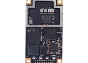
Phantom™ 40 GNSS OEM Board
- Multi-Frequency, Multi-GNSS
- GPS, GLONASS, BeiDou, Galileo, QZSS, and NavIC (IRNSS)
- Athena™ RTK, Atlas® L-Band, and SBAS-Capable
- 800+ Channels
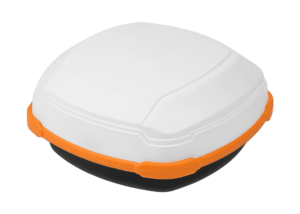
C631 GNSS Smart Antenna
- Multi-frequency GPS, GLONASS, BeiDou, Galileo, QZSS, IRNSS, and Atlas L-band
- Long-range RTK baselines up to 50 km with fast acquisition times
- UHF (400 MHz & 900 MHz), cellular, Bluetooth, and Wi-Fi wireless communication
- Athena GNSS engine providing best-in-class RTK performance
- Internal sensor corrects collected point coordinates to within 2 cm
LandMetrix™ OEM Agriculture Solution Toolkit
LandMetrix™ OEM Agriculture Solution Toolkit
Introducing Hemisphere GNSS’ new OEM application software and hardware for building your agriculture guidance and control systems.
Vector™ V200 GNSS Smart Antenna
- Single-Frequency, Multi-GNSS
- GPS, GLONASS, BeiDou, Galileo, and QZSS
- Atlas® L-Band and SBAS-Capable
- 511 Channels
- 10 Hz Update Rate (20 Hz Optional)
- 0.75º Heading Accuracy
Phantom™ 20 & 34 GNSS OEM Boards
- Multi-Frequency, Multi-GNSS
- GPS, GLONASS, BeiDou, Galileo, QZSS, and NavIC (IRNSS)
- Athena™ RTK, Atlas® L-Band, and SBAS-Capable
- 800+ Channels
S631 GNSS Smart Antenna
- Multi-frequency GPS, GLONASS, BeiDou, Galileo, QZSS, IRNSS, and Atlas L-band
- Long-range RTK baselines up to 50 km with fast acquisition times
- UHF (400 MHz & 900 MHz), cellular, Bluetooth, and Wi-Fi wireless communication


